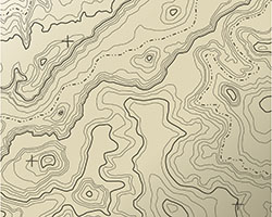
 Topographical surveys are used to map and identify the contours of the ground and existing features on the surface of the earth. If the survey is to be used as a base map for the design of a structure or road, it may also show perimeter boundary lines and lines of easements on or crossing the property being surveyed.
About Olson Surveying
Olson Land Surveying focuses specifically on the time honored practice of conducting accurate, professional land surveys in Walworth County, Wisconsin. By focusing specifically on surveys, Olson Surveying provides detailed work for all forms of residential and commercial real estate needs. From remodeling site surveys for local building permits to platting of business parks for legal transactions, Olson Surveying has the experience and municipal relationships to ensure your project is delivered on time and exceptionally accurate.
Recent Posts
Associations